Thursday, April 30, 2009

Google Earth Tours of Switzerland

Swiss Fighter Tour & Video Synchronisation

Frank Taylor, of the Google Earth Blog, has taken my hack of synchronising a YouTube video with the Google Earth plugin to create a stunning flight over the Swiss Alps.

Frank has taken a video of the flight of a Swiss Fighter Jet and recreated the flight in Google Earth. Playing the tour alongside the video really illustrates the power of Google Earth played in a browser.

Via: The Google Earth Blog

Google Earth Slideshow Tour

Inspired by Frank's use of YouTube and the Google Earth plugin it occurred to me that you can actually play any javascript application synchronised to a Google Earth plugin tour. In this example I have synchronised a Google Earth tour of Lake Geneva with a javascript photo slideshow created by Leigeber.

The Google Earth and plugin tour and the photographs are not exactly brilliant but I think it gives a good illustration of the possibilities of synchronising Google Earth with other applications.

________________

Swine Flu Maps Roundup

The recent outbreak of Google Maps Mashups of the Swine Flu epidemic shows no sign of abating. Instead of writing a new post every day (there have been four posts on Swine Flu already this week) I have decided that new maps on this subject will now just be added to this 'roundup' post.

Washington Post Distribution of Cases Map

The Washington Post has used the Google Maps Flash API to produce this map that is tracking the distribution of Swine Flu (H1N1) cases around the world. The map shows confirmed cases in red and suspected cases in black.

To learn more about cases at each location click on the map markers. The map uses marker clustering, therefore more individual cases will appear as you zoom in on a location. The Washington Post map also includes a number of buttons which will zoom the map to different countries around the world.

Previous Swine Flu Maps

________________

Create Your Own Sight-Seeing Google Map

Map The Burg

This Google Map mashup of downtown Fredericksburg, VA allows anyone to create their own sightseeing map of selected attractions, monuments, shops, bars and restaurants. It can even provide you with walking directions for your tour.

The map lets the user select mapped locations from a number of categories:
  • Restaurants
  • Nightlife
  • Hotels
  • Touring
  • Shops
  • Community
Whilst viewing a category, if you come across somewhere you would like to visit, you can click the 'Add to My Map' link and the location is added to your personal sightseeing map. When you have finished adding places you would like to visit on your tour of Fredericksburg just press the 'Walking Directions' button and you are presented with your own personal walking tour of the town.

________________

Wednesday, April 29, 2009

Maps of the Swine Flu - Part 4 (Updated)

Google Flu Trends

Google have now released a special Google Flu Trends page for Mexico. The page uses Google search activity in Mexico to help track human swine flu levels. Unlike the Google Flu Trends for U.S., this data is not validated against confirmed cases of flu but after conferring with US and Mexican health officials, Google decided to share these results "to provide additional information on the evolving epidemic."

The page includes an interactive Flash heat map of the Swine Flu outbreak in Mexico. Pointing at any region with your mouse will bring up a legend informing you of the current level of the outbreak in that area.

Via: Official Google Blog: Experimental Flu Trends for Mexico

Ushahidi Swine Flu Map

Google Maps mashups of the Swine Flu Outbreak are still being produced thick and fast. The latest comes from crisis information crowdsourcing website Ushahidi and is actually one of the best maps of the outbreak so far.

This Google Map of the outbreak allows you to filter the results shown on the map by Confirmed Cases, Suspected Cases, Confirmed Death, Suspected Death and Negative. Beneath the map is a graph showing the rise (and hopefully eventually the fall) in cases of Swine Flu. The user can adjust the dates to view a graph for any period and the data on the map will change to reflect the date range chosen as well.

Like all of Ushahidi's Google Map mashups users can submit information to the map by filling in a short form or by sending an SMS message.

Click2Map

Click2Map, the map creation website, have also produced a Google Map of the outbreak. The Click2Map Google Map lets the user filter the results shown on the map by Confirmed cases, Suspected cases, Deaths and Negative.

The map makes good use of numbered marker clustering which allows the user to get a quick overview of the extent of the outbreak in different states and countries. The Click2Map map also has a search facility so that the user can find a location on the map that they are interested in viewing results for.

Geotagged Swine Flu Videos

Another interesting way to keep up-to-date on the latest news about the outbreak is via this Google Map of geotagged YouTube videos about Swine Flu.

The map includes a number of videos about the outbreak, mainly from news channels. The map includes a handy forward and back button which makes it easy to skip forward to the next video.

Also See


Maps of the Swine Flu Outbreak - Part 1
Maps of the Swine Flu Outbreak - Part 2
Maps of the Swine Flu Outbreak - Part 3

________________

Finding Your Money on Google Maps

HSBC Bank Canada Map

HSBC Bank Canada have produced a Google Maps mashup to help customers locate bank branches and ATM's. The map allows users to enter any address and find their nearest HSBC bank or ATM machine.

It is possible to view both banks and ATM markers on the map or select to view just banks or just ATM's. The locations are shown both on the map and are listed in a sidebar. When you click on a bank or ATM marker it is also possible to get driving directions.

BNZ Branch Locator

BNZ Bank in New Zealand have also produced a Google Map that shows the locations of bank branches and ATM machines. The map helps customers discover branch opening times, branches with wheelchair access, drive thru banking sites and ATMs where you can make deposits.

It is possible to search the map for any location in New Zealand. The map also uses innovative marker clustering on the map which is reflected in the map sidebar. The cluster markers show how many branches there are in a particular location and the cluster markers are displayed not only on the map but in the sidebar.

Other Banks with ATM Locator Maps

Deutsche Kreditbank ATM's
Royal Bank ATM/Branch Locator
Bank ATM Map for Chile
Bank of Queensland (AU)

________________

Tuesday, April 28, 2009

Worst 'Grot Spots' on Google Maps

Google Map of the Dirty Dozen

Moreland Council, in the north of Melbourne, Australia has produced a great Google My Map to find, and clean up, the twelve dirtiest spots in Moreland. "Grot Spots" can be added to the map both by local residents and by council workers, so is a great way for the council to interact with and act on the concerns of local residents. A new "Dirty Dozen" of the worst spots is published every two weeks.

The map has "before" and "after" photos, customised icons and sometimes some colourful quotes by staff or residents about the particular 'grot spot'. The map is part of a campaign by Moreland City Council to clean up the city, stop illegal dumping, bust the myths on dumping and to let people know how to get rid of rubbish properly.

It's also a great idea!

________________

Monday, April 27, 2009

Swine Flu Outbreak (3) - Updated

Geocommons Maker! Maps

FortiusOne's GeoCommons have produced three new Google Maps to show areas around the world that have been affected by the current outbreak of H1N1 Swine Flu and areas that might be prone to the outbreak.

The first map (pictured above) has a really useful interactive timeline that shows the spread of reported cases throughout the world. Press play on the timeline and the map will animate. It is also possible to drag the timeline to view data for any given day.

Swine Flu Cases and Measures by Country

The second Google Map shows what different countries are doing to avoid the spread of the outbreak in their country. The map also shows the number of swine flu cases that each country has encountered so far.

Air Passengers between the US and Mexico

The third map from Geocommons shows the number of air passengers between the US and Mexico. The number of passengers is shown on the map by the size of the map marker. It is possible to click on the markers to get more detailed information.

Up2Maps Swine Flu Map

This is the first heat map of the outbreak that I have seen. The colour on the map represents the percentage of the world's possible cases of Swine Flu that each country has.

A heat map gives a very good quick overall impression of which countries are being affected by the outbreak and by how much.

Up2Nets have also produced another heat map of the outbreak called H1N1 Swine Flu Infected and Possible Infected

OpenFlu Map

OpenFlu have produced a simple Google Map that show the current cases of Swine Flu around the world. OpenFlu are also presenting the data in table form, so users have two ways to visualise the scale of the outbreak.

The OpenFlu data is being collated from The Guardian and a number of other sources.


Also See
Swine Flu Maps - Part 1
Maps of the Swine Flu Outbreak - Part 2
________________

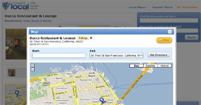
MySpace Local Using Google Maps

MySpace Local

MySpace in the US has started using Google Maps to show the locations of business listings. At the moment this seems to be a US only service (readers outside of the US will probably find the links in this post default to the MySpace domain for their country).

MySpace Local is a joint project with Citysearch. Citysearch are providing their huge database of business listings and MySpace are adding the social networking features, such as user reviews. Using MySpace Local it is possible to find a local bar or restaurant (or any other type of business) and read the user reviews before planning you night out.

Each featured business comes with a 'Get directions' link, which is where Google Maps comes in. Clicking on the link opens a lightbox type window with a Google Map of the business' location. At the top of the map it is possible to add your starting location and the map will return driving directions from there to the business.

________________

Press Releases on Google Maps

Press Releases Map

Earthpublisher.com have created a Google Map that anyone can use to publish a press release. The service is currently free so provides a good opportunity for companies to promote their latest news.

To help companies reach a relevant audience the website identifies the user's location. This enables the map to display only regionally relevant press releases and press releases only in the user's language.

The latest press releases submitted to the site are displayed under the map. Each press release under the map comes with a 'location' link. Clinking on the link centres the map on the company's location.

Via: Mapperz

Arthus-Bertrand's Home on Google Maps

Home
Film producer Luc Besson and the photographer Yann Arthus Bertrand announced today that their film Home, will be exclusively available on the Internet on YouTube in English, French, Spanish and German speaking countries, on the 5th of June for World Environment Day.

Home paints a portrait of the impact of humans on planet Earth using the stunning aerial photography of Yann Arthus Bertrand.


In addition to the film, five Google Maps have been created with information about the project. The maps will allow users to interact with the film content and will give information about the screening of the film, access to educational resources on the topics covered in the film and much more.

________________

Find Fast Food Along a Route

POI's along a Route Map

This Google Map mashup lets you find driving directions and will also show you fast food restaurants that you can visit along the route.

The map has some very nice features. There is automatic clustering of the map markers. It is also possible to define the range (in terms of distance along your route) that you wish to see results for. You can adjust the range using the slider control above the map. You can even select the distance off of your route that you are prepared to travel to visit a restaurant.

To top it all you can choose which chains of fast food restaurant that you would like to see results for.

________________

Sunday, April 26, 2009

Maps of the Swine Flu Outbreak - Part 2

H1N1 Swine Flu Timeline

Using the Google Earth plugin I've created a timeline of the H1N1 Swine Flu outbreak. The data comes from the H1N1 Swine Flu My Map.

Due to the inaccuracy of the data this map should be seen purely as an experiment. For example, the timestamps on the data seems to suggest that the outbreak spread from the USA to Mexico rather than the other way around. However the timeline does give a rough idea of how the outbreak seems to be spreading.

HealthMap

It is possible to follow the latest worldwide news about the swine flu outbreak on the excellent HealthMap. To view swine flu news make sure that you uncheck everything except for influenza in the 'Diseases, last 30 days' column.

HealthMap aggregates news feeds from the WHO, Google News, ProMED, and many other sources to provide the latest information from all around the world.

Swine Flu Tweets

If you want to track the reactions of the Twittersphere to the Swine Flu outbreak this Google Map is tracking the latest tweets that mention 'swine flu'. The map animates through the latest tweets as they are made.

It is possible to select which part of the USA (or Europe) you wish to see tweets from by selecting from the buttons on the left of the map.

Also See

Swine Flu Maps - Part 1
Maps of the Swine Flu Outbreak - Part 3

________________

Friday, April 24, 2009

Live Storm Chasing on Google Maps

Discovery Channel Storm Chasers
Watch live streaming video of storm chasers on this Discovery Channel Google Map. The Discovery Channel's Storm Chasers and additional teams, hand-picked by Reed Timmer, are being tracked and are broadcasting live on this iMap Weather map.

As well as tracking the storm chasers the map shows the latest weather so that users can see the interaction between severe weather conditions and the storm chaser's activity. The vehicle map markers only appear on the map when the teams are on the move and have activated their GPS, video and other data.

If you can't see the cars on the map then you can get a good idea about the awesomeness of this map from the screencast below:


Storm Chasers on Vimeo.

________________

Click2Map Adds New Features

Click2Map
The Google Map creation tool Click2Map have just unveiled a number of new features that allows users to more deeply customize the look and feel of the Google maps they create. Every element of the map is now customizable: the header, footer, fonts, sidebar, colours, driving directions and even the address finder.

The video below shows some of these new customizable features in action:


Another new feature allows users to add a URL and email to the footer of the map. This will help your created Google Map become a more effective lead and traffic generation tool.

________________

Mad Friday Maps Fun

Mad's 500th Issue

Wired have managed to get a sneak peak at next week's 500th edition of Mad magazine, which contains a close examination of the Google Maps satellite image of the Google headquarters in Mountain View, California. Under close examination it appears the satellite imagery reveals many of Google's secrets, like the room that houses the Chinese censors responsible for erasing all references to Tibet on the internet and the office where all your porn searches are filed ready to be leaked should you ever decide to run for office.

TeamNames.net

TeamNames.net is a sports stadium/venue search tool built on Google Maps. Using the map it is possible to browse the satellite images of sports stadiums around the world. Once at a stadium view it is possible to get directions or to view nearby stadiums.

Currently the map shows venues from a number of sports leagues, including, NBA, MLB, NFL, MLS, NHL, EPL, etc. New teams and sports are being added each week.

The Sandrific Slimbox Tutorial

Earlier this week Google Maps Mania reviewed Betsy Kimak's excellent Sandrific.com website. Sandrific.com uses Slimbox to create Lightbox type image windows above the Google Map when a user clicks on a thumbnail image in a map information window.

Betsy has a great turorial on her personal blog that explains how map developers can use Slimbox to create a similar effect on their own maps. To prove the tutorial works, here are a couple of maps created by users following Betsy's excellent tutorial,

Save and Share Directions With My Maps
Google Maps has added a new option to driving directions that lets you save your finished directions as a Google My Map. This means that now it is even easier to share your driving directions with friends.

There is also a new tool in driving directions called 'Draw a line along roads'. With this tool when you drag a line it should snap automatically to follow the line of the roads on the map.

Via: Google LatLong: Save and share directions with My Maps

Thursday, April 23, 2009

Geo-Tagged Crime on Your Mobile

SpotCrime i-Phone Application

Spotcrime, the online crime mapping site, has released an i-Phone application. The app lets you view a map of your location with recent crime data tagged to the scene of the crime.

As well as the Google Maps view of the crimes you can also receive local crime data in the form of a text list. Both the map and list view will tell you how far away the crime took place, how long ago and what the details were.

This could prove an invaluable tool when you visit new towns and cities. It could help to show you the areas that it might just be best to avoid.

______________

Mapping Tracks With the Google Earth Plug-in

Eremitageløbet Route

The Eremitageløbet is Denmark's oldest road running event. This year's race is scheduled for the 4th October and many runners have already started their training for the event.

For those training for the race and for anyone else who has an interest in the event Søren Johannessen has created this Google Earth plug-in tour of the race route. The tour gives the viewer a fly though of the route and is accompanied by a soundtrack of Lars Krimi's 'Distorted Dreams'.

Formula One Tours
Thekmz.co.uk has created a kml of all the 2009 Formula 1 Grand Prix tracks. The kml file contains tours of the tracks so that now you can pretend you are Lewis Hamilton flying around Monaco at 180 mph.

______________

Open Source World Google Map

Open Source Activity Map

Red Hat have published the results of a collaborative research project with Georgia Tech to determine the level of use of open source software in different countries. Redhat have produced an interactive Google Map so that the data can be explored interactively.

You can click individual countries on the map to see their ranking and scores. The countries were ranked by overall activity. Europe ranks high in the global index, which lists France, Spain, and Germany as the countries with the highest level of open source activity. The United States came in ninth place.

Biographies on Google Maps

QuoVadis Live! Tracks

QuoVadis Live!, the Google Map creation tool that allows anyone to map events and tours, has today added a new feature that they are calling 'Tracks'. Tracks allows anyone to create a biographical map of someone famous or of their own life.

QuoVadis Live! have created an example 'Track' of the life of USAF Fighter Pilot Col. John Boyd. The map tracks John Boyd's life from his childhood right through to his burial in Arlington National Cemetery. Major events in Boyd's life are marked on the Google Map with blue circular markers and the events are explained in the map side panel.

Like all maps created with QuoVadis Live! Track maps can be embedded on any website or blog. It is therefore possible, if you so wish, to create a mapped resume and add it to your website.

______________

Wednesday, April 22, 2009

Google Maps on your Nintendo DS

Ranger

Ranger claims to be a fully functioning GPS navigation system for the NDS console. The Ranger uses Google Maps to show the user's current location, the current direction and speed of travel and nearby points of interest.

In addition to Google Map's traditional 2D flat map display the Ranger can convert the map tiles into a more 3D like view. Ranger also claim that the device cab be connected to the USB port of a laptop and therefore turn any computer into a navigational device.

Twitter + Street View = Stweet

Stweet

There have been a few Twitter and Google Maps mashups but Stweet is the first to show Twitter messages on Street View. Stweet displays geolocalised tweets from Twitter on top of a Google Street View panorama. The Street View image refreshes for each new Tweet.

Stweet is obviously only available in cities that currently have Street View coverage. However it is possible to search for messages in a number of cities around the world by selecting from a drop down menu.

Via: GeoInWeb

______________

Webby Nominated Maps

Isn't it time that the Webby Awards created a Best Use of Maps or a Location Aware category? Four of this year's Webby nominees are mapped based websites and of course many of the other websites, particularly in the travel and real estate categories, feature maps somewhere in their service.

Sandrific.com

Sandrific.com is a nominee in the Personal Web Site category and is a great example of how Google Maps can be used to help share a personal passion with the world. The website features mapped photos of sand collected by Betsy Kimak.

With the help of family and friends, who have brought sand back from their vacations, Betsy has amassed a collection of sand from beaches all over the world. Using Google Maps and Slimbox, Sandrific.com has created an attractive interface to present geo-tagged photographs of her large sand collection.

Britglyph
Britglyph is a nominee in the Net Art category of the Webby's. I had the pleasure of meeting Alfie Dennen, one of the brains behind Britglyph, earlier this year. To my eternal shame I have told Alfie at least twice of my eagerness to review Britglyph on Google Maps Mania, and both times I have promptly forgotten to actually do so.

Britglyph is an amazing collaborative art work in which 61 people carried a rock to 61 locations in the UK, they then took a photograph of themselves with their rock and then sent it in to the site with the GPS location of the photograph.

The result is an incredible image of a timepiece drawn on top of a map. The finished art work is a symbolic representation of John Harrison's Marine Chronometer H5, the tool which effectively solved the Longitudinal problem.

Birdpost
Birdpost Map
Birdpost is nominated in the Social Networking category. We first featured Birdpost on Google Maps Mania in October of last year. The site is designed to allow bird watchers to report bird sightings and find the bird sightings of other bird watchers.

You can use Birdpost's Google Map to either report bird sightings or find out about bird sightings in a particular area. To add a bird sighting the user just double clicks on the map and completes a short form. To find sightings the user just types a location into a search box. The map then centres on that location and shows previous sightings with blue markers on the map and lists the birds in a side panel.

Bird watchers can also use Birdpost to create an on-line chronicle of the birds they have seen, share their chronicles with other Twitterers, connect with other bird watchers and create e-mail alerts for sightings of rare birds.

VisitSweden


VisitSweden is nominated for a Webby in the Tourism category. VisitSweden was first featured on Google Maps Mania back in 2007 and is Sweden's official website for tourism and travel information.

VisitSweden has created Google Maps for each of Sweden's main regions. The maps each have a number of layers that can be selected to find interesting places to visit in the country. The layers include Culture, Family vacation, Nature experiences, Outdoor activities, Gastronomy, Coastline experiences, Wellness, Design and Airports.

______________

Time Your NY Journey on Google Maps

Triptrop NYC

This amazing (and rather pretty) Google Maps mashup can tell you how long it takes to get anywhere in New York from anywhere else in the city. Using the map is very, very easy, you just enter your address and press the 'map it' button. The map then adds an overlay that is colour-coded to show the time it takes to get anywhere else.

There is even an option to compare two different addresses. Enter two different addresses and two maps are shown side by side. The estimations on the travelling times comes from station-to-station commute time data from the Metropolitan Transit Authority, and walking calculations are via Manhattan Distance at 3mph.

Triptop NYC is similar in concept to Where-Can-I-Live, which displays London properties on a map based on commute times. I think there is a huge potential here for Triptop to be mashed up not only with real estate data but with data about nearby bars and restaurants.

Just adding the GoogleBar control to this map would allow users to quickly view bars and restaurants within ten minutes of any location (and allow the developer to earn a little income from the new targetted advertising in the GoogleBar control results).

______________

Tuesday, April 21, 2009

UK Google Maps Mashup Round-up!

Hackney Where?

Hackney Where? is another great Google Maps mash-up produced by a London local council. The map allows anyone in the borough of Hackney to enter their address and find out which electoral ward they belong to and who is their MP and local councillors.

The map comes with a range of other features as well. Using the map it is possible to see if there are any planning applications for your neighbourhood and view the latest air quality results. It is also possible to find out the nearest schools, doctors and car parking spot.

The map also comes with a tab to add a number of layers to the map. These layers include council offices, city farms, libraries, sports facilities etc.

Virtual Tour of the Lake District

This virtual tour of the UK's Lake District uses the Google Earth plug-in to take you on a journey around some of the most beautiful spots of this national park.

When you start the tour the map zooms in on a location and loads a description of the area. The user is then able to use the 'next' and 'previous' buttons to navigate through the other locations. Although this map is not produced by an official tourist agency it does demonstrate how the Google Earth plug-in can be used to promote areas for potential visitors.

Via: Mapperz

Geograph Cluster Map

The Geograph British Isles project aims to collect geographically representative photographs and information for every square kilometre of Great Britain and Ireland. The site has just added a Google Map to its website that uses the Geocubes clustering solution to map 1.25 million submitted photos, covering nearly the whole of the UK.

______________

Monday, April 20, 2009

Remembering Columbine

SchoolShooting.org

SchoolShooting.org is a new service, just launched, by Washington Ceasefire, which is a non-profit organization that seeks to reduce gun violence mainly with a focus on Washington State. The new website was launched to commemorate the 10th anniversary of the Columbine shooting in the hope that it will spread awareness about gun violence in schools, not just in Colorado and Washington, but on a nationwide basis.

Integral to the new website is a Google Maps mash-up displaying the 291 school shootings that have occurred since 1992. The foundational database was contributed by the National School Safety Center, but it has subsequently been enhanced by SchoolShooting.org and the site provides a form for users to submit data on a school shooting not already mapped.
______________

Catalan Comms Data on Google Maps

Cercador de Cobertures

The Government of Catalonia has produced a Google Map to give the public monthly updates on the coverage of telecommunication services in Catalan. The web site uses both Google Maps and the Google Earth plug-in to allow citizens to view the coverage of DVB-T services, rural-based broadband technology and mobile emergency call data.

Using the map it is possible to search for any Catalan municipality and view up-to-date coverage of telecommunication services in the area. The site uses spatial information from various sources, including the Cartographic Institute of Catalonia ICC, Google and various communications operators.

______________

Another Google Maps Design Portfolio

Academie Arnhem Portfolio Map

The Academie Arnheim have used custom map tiles with the Google Maps API to present the work of the final examination candidates of The ArtEZ Academy of Arnhem. The academie has replaced the Google Map tiles with custom tiles created from images of the students' work. The images represent the artistic work of the students after four years of studying at the acadamie and mark the start of their career as artists, designers or teachers of visual arts and design.

It is possible to use the Google Maps interface to pan around the different art works and to zoom in for a closer work at individual pieces. The acadamie has also done some impressive programming (with jquery I think) to overlay text links on each of the student's work. Clicking on any of the links loads information, directly onto the map, about the art work.

Also See

Kalle Hagman - another design portfolio using custom map tiles with the Google Maps API

______________

Democracy Works on Google Maps

Richmond Council in London have released a number of Google Maps that are designed to help local residents find local government offices and services. They have also created several different 'green' maps to show the locations of eco-homes, schools with solar panels, green businesses, fair-trade shops and farmers markets.

Map of Council Offices & Local Facilities

The council have created a number of Google Maps showing not just the location of local government offices but the locations of local schools, libraries, polling stations, cemeteries, sport and fitness centres, car parks, halls for hire and allotments.

Green Maps
Richmond Council have also produced a number of Google Maps designed to help local residents be more environmental friendly. Under the banner of 'Go Green Richmond' the council have created maps for local green businesses, renewables, eco-homes, fairtrade and organic shops, farmers markets, charity and re-use shops and car club organisations.

There is also a Google Map showing all the recycling locations in the area.

Via: Mapperz

_________________

I Want to Teach the World to Sing

SingTheWorld

SingTheWorld is a Google Maps jukebox and photo viewer. When the map first loads the user is asked to click on a tag. SingTheWorld then plays a song related to the tag and animates through photographs from Flickr with the same tag.

Once the animation begins you can, as the map says, "Just relax and let the music free your mind." If the music and the photographs fail to free your mind then you can choose from other tags that appear beneath each Flickr picture.

_________________

Sunday, April 19, 2009

Google Latitude Added to Orkut

Google Latitude Orkut Application

Google have created a Google Latitude application for the social networking site orkut. The Google Latitude application lets orkut members share their location and see their friends' locations on a Google Map inside of orkut.

If members use Google Latitude from a mobile phone, they can even send updates about their location to their friends on orkut while they are out and about.

Via: orkut Blog: Google Latitude on orkut- share your live location with friends

_________________

Saturday, April 18, 2009

Tracking Bangalore Buses on Google Maps

Bangalore Live Bus Tracking

This site is tracking buses of the Bangalore Metropolitan Transport Corporation live on a Google Map. The buses all carry GPS units so the map is able to update locations once a minute.

It is possible to track all BMTC buses at once or select an individual bus to track. If you click on a bus map marker you can get the route information and speed of the bus. There is also a mobile phone version of this map, so it is possible to work how long you will have to wait for a bus when you are out and about in Bangalore.

This map comes from the same developer as the Indian Train Tracker.

Other Indian Google Maps Mashups

_________________

Friday, April 17, 2009

The Guilty Pirate Bay Map

Dipity Pirate Bay Timeline

Dipity have produced an interesting time-line of Pirate Bay. The Dipity time-line widget includes a Google Map option which allows events to be plotted geographically as well as chronologically.

The map includes a 'play' option which animates through the events on the map. In this case the animation works backwards. It starts with today's guilty verdict and works backwards to 2003 and the creation of the 'Bureau of Piracy'. I guess the four co-founders of The Pirate Bay might be wishing that it was so easy to turn back time.

Via: The Guardian

_________________

Google Maps Friday Fun

Google Moon (Part II of "The Googling")
The Vactioneers, the guys behind the hugely popular viral YouTube video about Google Maps, have produced part two:


The guys also have a movie coming out soon called The Scenesters. You can watch the trailer here.

Street View of the Week
Don't bother waiting for the green light here. This confusing mess of traffic lights is actually a sculpture by Pierre Vivant in Canary Wharf, London.

The sculpture is over eight metres tall and has 75 fully working traffic signal heads. Vivant says that,

"The Sculpture imitates the natural landscape of the adjacent London Plane Trees, while the changing pattern of the lights reveals and reflect the never ending rhythm of the surrounding domestic, financial and commercial activities."

Via: Street View Gallery

Open Street Maps Street View

Sightwalk have some nice interactive panoramic images of the Rheinpark in Cologne. They are using Open Street Maps to show the location of the images. Like Street View it is possible to navigate from one image to the next via arrow links embedded directly in the panoramas.

Hopefully this will spur Google to release Street View in Germany soon.

Via: Geoblogger.eu

Google Maps Typography

The Heavy Backpack website have produced an alphabet of letter shaped images found in Google Maps satellite images. All the images were found within the state of Victoria, Australia.

If you like this kind of thing then you will love GeoGreeting.com. GeoGreeting lets you send a message to a friend using letters found on Google Maps.

Alternatively, you could try MapMSG. MapMSG lets you send a smoke signal message on Google Maps!