
The United States Geological Survey are using Google Maps to display a large number of data sets that can be downloaded from USGS. The data available to download fits in to three main broad categories; Aerial Photography, Map Products and Satellite Products.
The map lets you explore the available data for a specific location. Once you have selected a location you can search against one or more data sets at the same time. You can obtain information about each of the data sets by clicking on the information icon next to each data set.
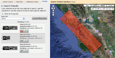
The Results tab lists the results of your search. 10 records for each data set are displayed at a time. If you then select the 'download' button you can export the metadata in multiple formats including KML, shapefile, and delimited text file.
Hat-tip: Mapperz
______________
1 comment:
another incredibly helpful tip for land surveyors! thanks!
Post a Comment